On the southernmost edge of Thera, the main island of Santorini, the principal town of this civilization outside Crete was entombed and preserved by ashfall from the eruption. Was this the metropolis of Atlantis?
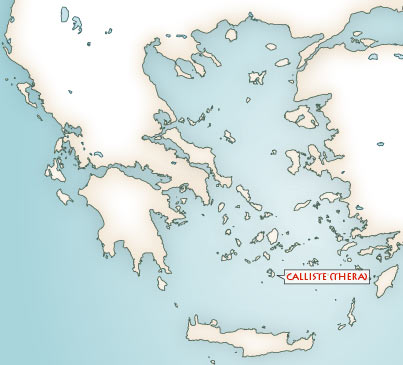
Figure 1: Location of the Thera (Santorini) island
It has been suggested that along the way, perhaps in transposing the story from Egyptian to Greek for Solon, there was a translation error, that Plato was really describing locations on two different islands, that the plain round the royal city was the Plain of Mesara on Crete, while the metropolis was on Thera.
Thera’s location, central in the Aegean and southernmost of the Cyclades, goes far towards explaining why it became prosperous in the bronze age. Within the small ring of islands – Thera, Therasia and Aspronisi – is a huge oval bay 10 kilometres across, the focus of the eruption that destroyed the bronze age civilization on Santorini. Where once hill country rose to volcanic peaks, the sea is now 400 metres deep. The steep walls of this caldera showing the layers of ash and lava of ancient volcanic eruptions give the bay a hostile coastline. Santorini’s main town, Phira, perches on the caldera rim, overlooking the bay. Today there are thirteen villages on Santorini and 6,000 people. Thirteen rural settlements are known from the bronze age too, but given the processes of destruction and burial it is unlikely that that we will ever see the complete pattern.
Ancient Santorini was probably more populous than today, with over 6,000 people in the city of Akrotiri alone.

Figure 2: Santorini or Thera, showing the location of the bronze age city at Akrotiri
Santorini suffers serious climatic problems, including perennial drought. Add earthquakes and volcanic eruptions, and Santorini becomes a very hostile place.
The Aegean has always been dangerously earthquake-prone; here the African plate, invisible beneath the Mediterranean floor, drives slowly but inexorably under Europe. All Aegean islands are prone to earthquakes. The effect of the 1956 earthquake is still felt in Santorini. Forty-eight were killed and hundreds injured.
The Aegean has always been dangerously earthquake-prone; here the African plate, invisible beneath the Mediterranean floor, drives slowly but inexorably under Europe. All Aegean islands are prone to earthquakes. The effect of the 1956 earthquake is still felt in Santorini. Forty-eight were killed and hundreds injured.
The ensuing panic and disruption of everyday life caused many to leave, reinforcing a century-long trend to move to an easier life on the Greek mainland. Since 1956 hot gases and sulphurous emissions have steamed continuously from the craters and fissures in the middle of the bay. The forces that ravaged Santorini in 1956 will do so again as they did in antiquity, when they emptied it of its bronze age Atlanteans. In the centre of the caldera are the two newest islands in the Santorini group, Palea and Nea Kameini, the Santorini volcano rebuilding on its old foundations. Though no more than a few tens of metres high out of the water, they have been built to that height from the seabed, so they are already substantial volcanic peaks.
The first documented eruption was in 197 BC, when people from Rhodes saw an eruption that resulted in the creation of a small island: they called it Iera, ‘holy’, and dedicated an altar to Poseidon, the god of the Atlanteans.
For the volcano to have broken the sea surface in 197 BC it must have been building up to that level during a series of earlier eruptions that went unreported. Wave action later eroded the topof this volcano off, creating the Bankos Reef.
PART ONE OF THIS STORY @ Atlantis - Facts
For the volcano to have broken the sea surface in 197 BC it must have been building up to that level during a series of earlier eruptions that went unreported. Wave action later eroded the topof this volcano off, creating the Bankos Reef.
PART ONE OF THIS STORY @ Atlantis - Facts


0 komentari:
Objavi komentar